When you feel an earthquake, you know the intensity of shaking depends on how big the earthquake is, how far away it is, and what kind of ground you’re standing on. But there’s another factor at play that’s like the Doppler effect of earthquakes. Just as the sound of a train coming towards you is of higher pitch than when it’s travelling away from you, so too will the shaking intensity you experience in an earthquake be greater if the fault is rupturing towards you rather than away from you.
For sideways-moving faults like New Zealand’s Alpine Fault, it would be useful to know whether the next earthquake will rupture towards populated centres such as Greymouth, Westport, Nelson, and Blenheim or rupture away from them towards the sparsely populated Fiordland. Determining the rupture direction directly from faults is not something that earthquake geologists have been able to do – until now.
In their Marsden-funded research, earthquake geologists Russ Van Dissen (Te Pū Ao GNS Science), Jesse Kearse, Tim Little (Te Herenga Waka Victoria University of Wellington), and Nicolas Barth (University of California Riverside) teamed up with geophysicist Yoshi Kaneko (Kyoto University) to bring field-based structural geology and physics-based modelling components together to elucidate fault rupture direction. Could they work out which way faults had broken in past earthquakes?
The concept started with the magnitude 7.8 Kaikōura earthquake in 2016. In this event, the Kekerengu Fault broke along its full 26-kilometre length with one side of the fault slipping up to 12 metres past the other side. Timing from seismographs showed that the fault ruptured from southwest to northeast – towards Cook Strait.
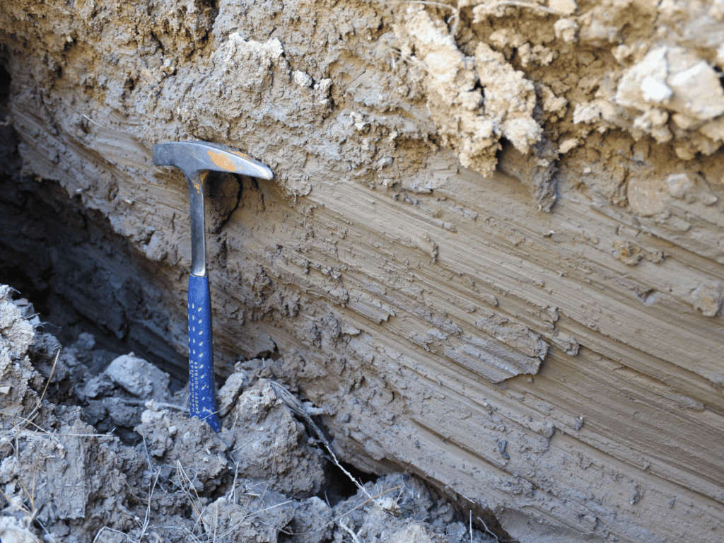
After this earthquake, researchers noticed that one side of the fault had scratched the other side leaving carvings on the fault plane. These fault markings have been observed worldwide and are known as “slickenlines”.
Jesse and the team were particularly interested in the curved slickenlines on the Kekerengu Fault. Using dynamic rupture modelling to simulate field observations, they demonstrated for the first time, that curved slickenlines could be used to determine rupture direction. A bit like a bulldozer pushing a pile of rock, convex upwards curves showed where rock was being buckled upwards as the earthquake happened (front end) and convex downwards curves formed where rock was being pulled down and away (back end).
The big challenge in this Marsden project was to take findings from the Kekerengu Fault (with an earthquake of known rupture direction) and apply them to the Alpine Fault (where past rupture direction is unknown and of high consequence). With careful excavation of fault surfaces at several locations along the Alpine Fault, the researchers were able to find and measure curved slickenlines from past earthquakes.
Slickenlines discovered on the Alpine Fault indicate that the fault ruptured from the southwest towards the northeast in the most recent earthquake. This would have resulted in very strong to severe shaking for the regions of northern West Coast, Tasman, Marlborough, and Canterbury. Evidence was also preserved of the fault rupturing in the opposite direction in an earlier earthquake.
Untangling the full history of rupture dynamics for the Alpine Fault was beyond the scope of this study. But the researchers are excited to have developed a new tool – and one that has the potential to be used globally to help society better prepare for future large earthquakes.

